
TL;DR – We continue our project of mapping historical video games with a look at Mohawk Games’ Old World
Mapping Old World –
One of the joys I have discovered working on this site has been our mission to map historical video games. We started with Civilization, followed up with Humankind, and our next mission is Old World. I had played a bunch of Old World when it was back in beta, and now that its next expansion, Pharaohs of the Nile, has arrived, I knew it was time to jump into this map.
Before we dive in, a couple of quick notes: while all attempts have been made to ensure that everything is accurately placed, putting this together meant working from multiple sources, map projections, and sometimes not firm locations. As such, no matter how much you try, there might be slight discrepancies. This is increased in places with many locations grouped into a small area [cough Greece cough]. So take this as indicative of the place, not a pinpoint location. Also, some entries could be one of several different locations; in that case, I had to make a call about which one it was.
The Nile River Valley

Click Here for full sized map
As the next expansion is about the Pharaohs of Egypt, starting our map in the Nile River Valley makes sense. Here, we get one of our significant location areas with the Nile River Delta, which makes sense as to how important it was in the era as a food-producing location. While it was mostly an easy job putting the cities in because this is an area I have mapped on many occasions. However, there was one location when putting the geographical locations in that I had to hunt through multiple journal articles written in the 1930s to nail it down.
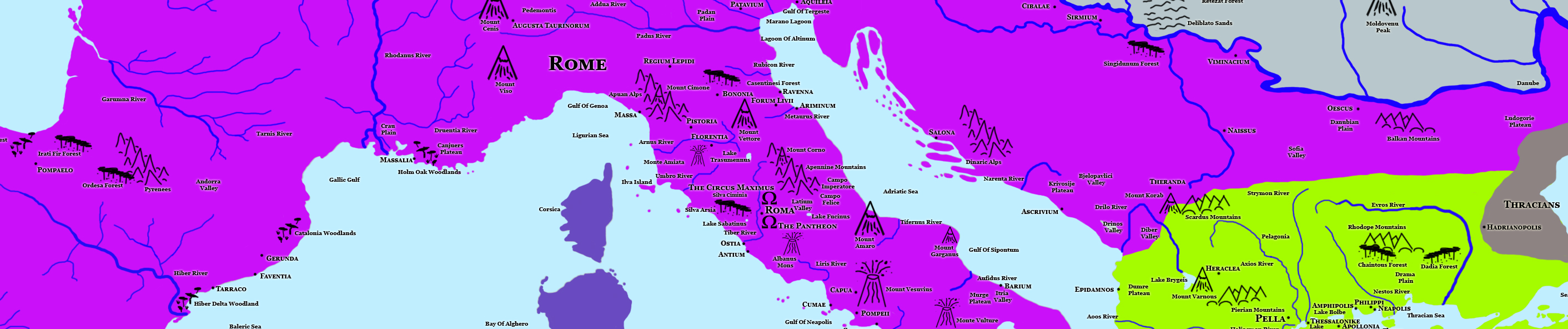
Rome
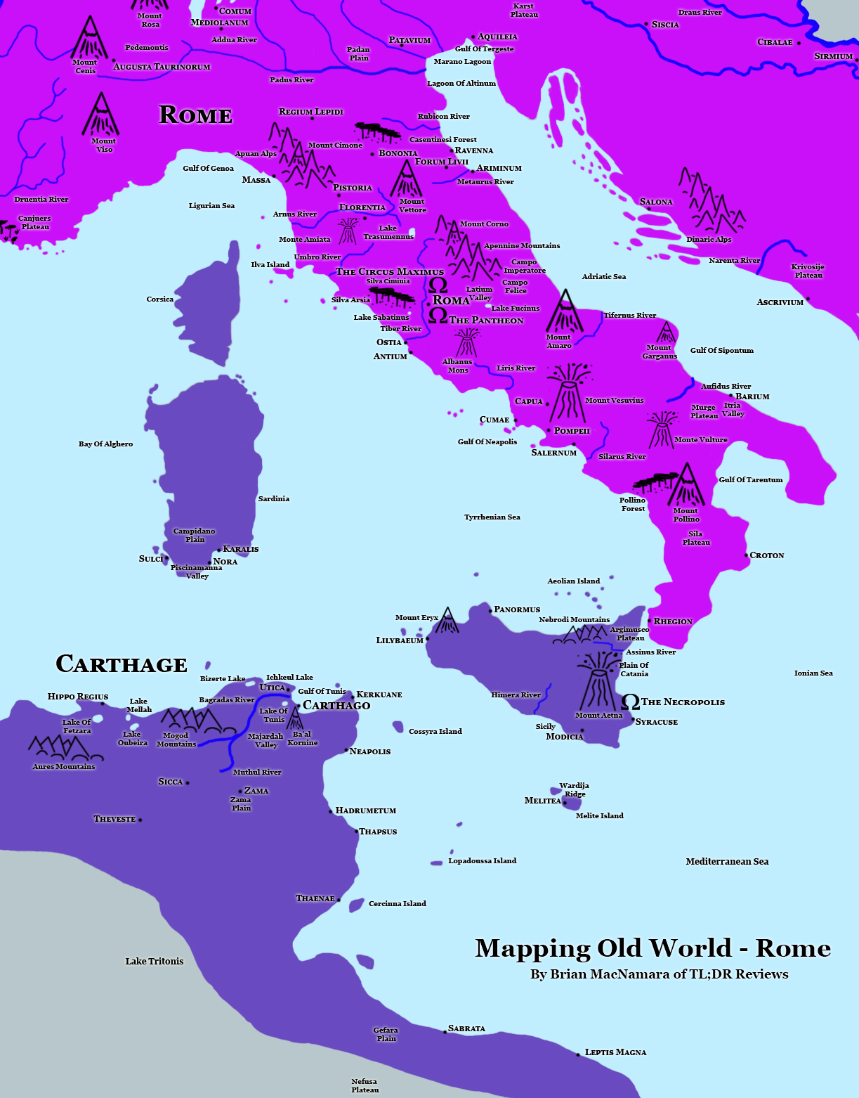
Click Here for Full sized Map
We can’t explore the Old World without looking at two of the significant protagonists for control of The Mediterranean Sea. The Punic Wars between Rome and Carthage shaped the region’s history, and I always find it interesting to see just how close the two sides were in dominating the oceans. One thing you might not see clearly on this map is Greece’s role in settling the area. As many of the Nations featured in this game conquered the others during their life, I had to make some calls with the territorial borders.
Mesopotamia
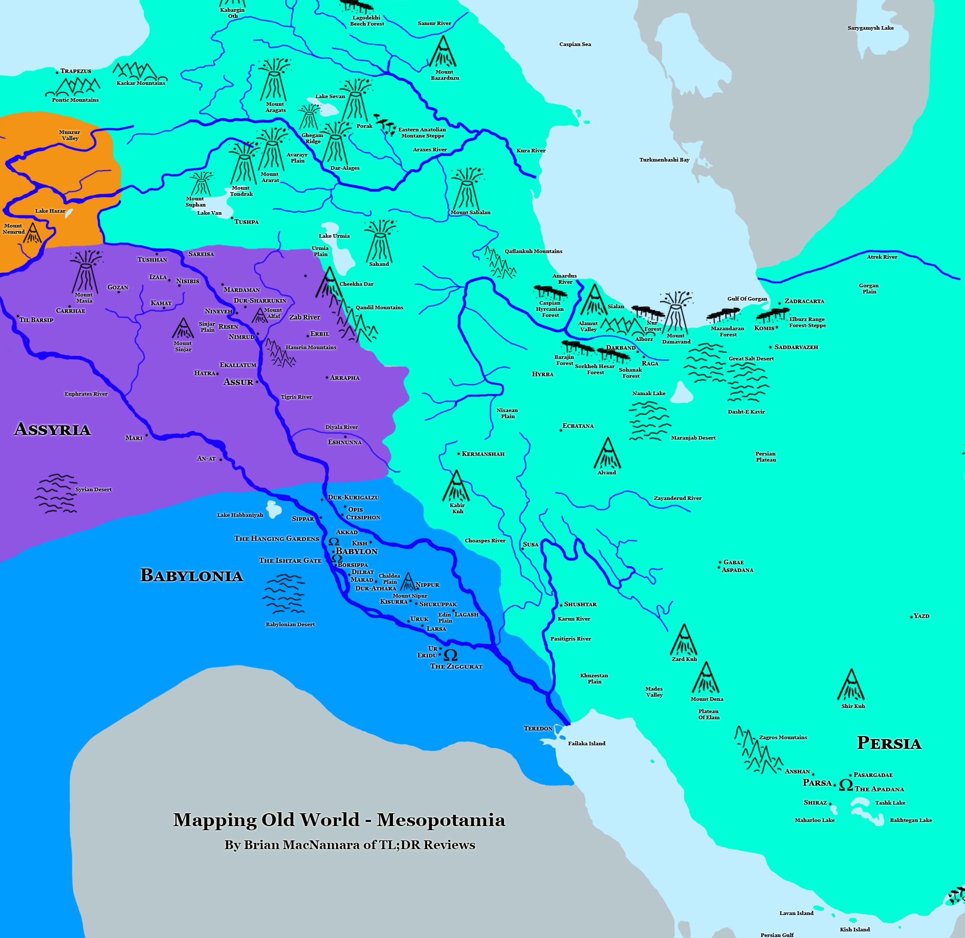
Click Here For Full Sized Map
The other power centre of the game comes from Mesopotamia, which spreads out from the confluence of the Tigris and Euphrates Rivers. In many of my other maps, this region gets a bit squished. However, I am happy with how it turned out this time. It also makes the most of the improvements of the third version of the map with a proper Caspian Sea this time around. I wish I could have shown the extent of the Babylonian and Assyrian Empires, but I hope I have done enough to suggest them here.
Greece
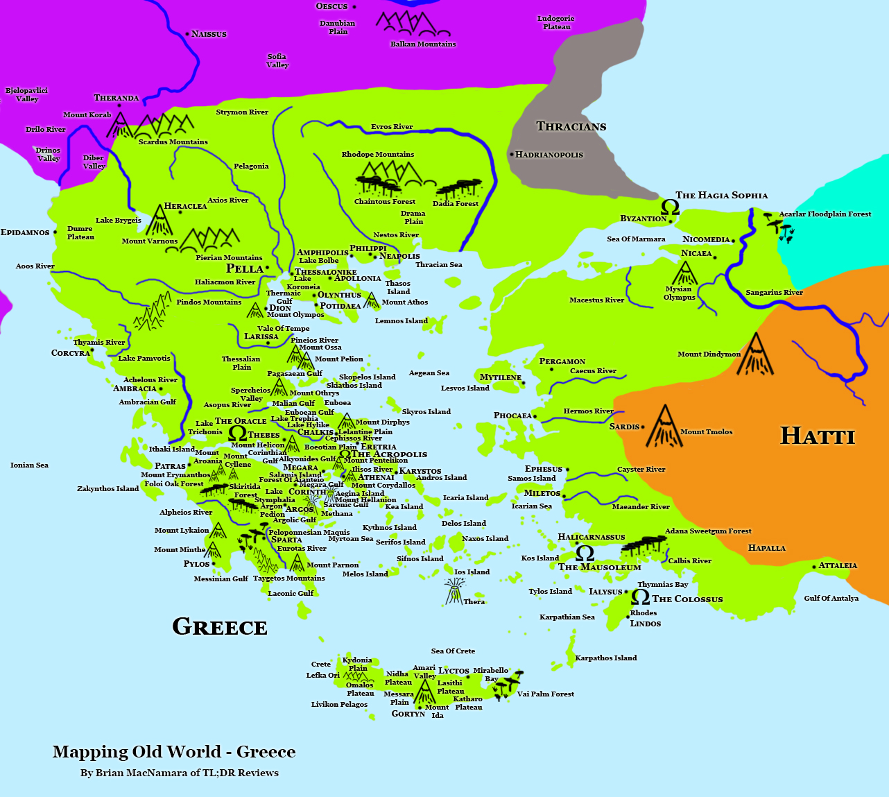
Click Here For Full sized Map
When I started this mapping project, I first worked on the geographical locations. I am glad I took this view because I had no idea how many places in the greater Greek area were when I started. It took a lot of careful placements even before I put the cities in. I breathed a sigh of relief that many cities ended up being in Anatolia until I remembered that I had to add in World Wonders. Because this map is very cluttered, I have given you a version below, with all the features removed, so that you can see the city locations more clearly.
Full Map
When I went into this project, I thought the smaller geographic area would make it a more manageable beast to capture. I was wrong. Of course, it didn’t help that I decided to do a significant update of the main map halfway through. Given how Mediterranean-centric the game is, I was most interested in seeing just how far the map would go. It also meant it was time to jump back into the game and give it another whirl.
Credits –
– The World Map that we used as a base several iterations ago was created by ‘San Jose’ which is shared with a Creative Commons Licence.
– The Nation detail maps America, Antarctica, Anticosti, Argentina, Australia 1, Australia 2, Azores, British Isles, Canada, Cape Verde, Canary Islands, Caribbean, Caspian Sea, China, Cook Islands, Europe Relief, Falkland Islands, Faroe Islands, Fiji, France, French Polynesia, Funchal, Gilbert Islands, Germany, Great Lakes, Greece, Hawaii, Iceland, India, Italy, Jan Mayen, Japan, Karachi, India, Madagascar, Maledives, Marshall Islands, Mauritius, Micronesia, Micronesia, Newfoundland and Labrador, New Zealand, Netherlands, Northern Mariana Islands, Provinces Maritimes, Réunion, Samoa, Scandinavia, Seychelles, South Africa, South Georgia, Spain, Taiwan, Tonga, USA Midwest and Northeast & Vietnam that we used for reference were shared with a Creative Commons Licence or was in the public domain. They were originally created by Aotearoa, Alexrk2, Antigoni, CIA, Dr Wilson, E Pluribus Anthony, Frantishak, Fut Perf, HectorMoffet, Htonl, Kelisi, Koyos, L. Claudel, Li Chao, Maximilian Dörrbecker, Mrflip, Mysid, NASA, NgaViet, NordNordWest, Phizzy, Radosław Botev, Saqib Qayyum, Sémhur, Shadowfox, Silver Spoon, Sting, Szczureq, The Emirr, Tschubby ,Tubs, Tyk, United States Corps of Engineers, United States Department of the Interior, Uwe Dedering, Visitor from Wikishire, Wikimedia Commons, Yavidaxiu & Yug.
By Brian MacNamara: You can follow Brian on Twitter Here, when he’s not chatting about Movies and TV, he’ll be talking about International Relations, or the Solar System.
Have you played Old World? let us know what you thought in the comments below, feel free to share this review on any of the social medias and you can follow us Here. Check out all our past reviews and articles Here, and have a happy day.

.png)
.jpg)
.svg)
.svg)
Pingback: Old World Cartographic Educational Database – | TL;DR Movie Reviews and Analysis